| ketchikan yacht clubEst. 1933 at 55°20.5'N, 131°38.7'W, in Thomas Basin, Ketchikan, AK |
Upcoming Cruising Events
- No upcoming events
Cruising
Cruising Local Places In Southeast Alaska
By ML Dahl, S/V Peaches, Ketchikan, Alaska
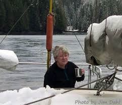 It does not matter whether you are a visitor experiencing Southeast Alaska for the first time, or a local returning to your favorite cove again and again; Southeast Alaska is ideal cruising grounds for the adventurous mariner.
In calm weather, cruising around the Ketchikan area seems almost idyllic and surreal with so much beauty, bounty and unspoiled wilderness, but be aware that danger is ever-present.
The waters of Southeast Alaska can go from extremely deep drop-offs on a rocky shoreline to submerged rocks and peaks just inches below the water’s surface, miles from a shoreline. Cruising in these waters requires close attention to up-to-date charts, careful navigation in rocky areas and respect for the large tides that can create heavy currents which can prove to be difficult to overcome in some channels.
In addition, Mother Nature can… and does… whip up storms in a jiffy, leaving the unprepared mariner in a precarious and sometimes dangerous situation. Summer temperatures can vary by 20 degrees within only minutes, due to an approaching weather front, which can exit as fast as it entered.
 Nevertheless, the areas around Ketchikan and RevillagigedoIsland are rich with cruising opportunities. It is possible to cruise at 6 knots for 4-5 hours, dock, catch a buoy or anchor out every night of a long cruise, even if you are voyaging for months at a time.
Once in the Ketchikan area, moorage should be established starting in Thomas Basin at the Ketchikan Yacht Club, where you can dock on a transient basis and use the services of our historic and quaint, 75 year-old clubhouse, which features a modern kitchen, a shower, men and women’s bathrooms, a TV, a local telephone, a washer and dryer and a comfortable living room for members and guests to use. Other moorage spaces are available in ThomasBasin on the other floats, in City Float (Casey Moran harbor), and Bar Harbor North and Bar Harbor South.
All of these cruising destinations are within a 25 mile distance from downtown Ketchikan harbors and make great weekend or overnight trips for the mariner wishing to explore Southeast Alaska.
Starting your day cruises from Ketchikan:
1. Black Sands Beach and Bostwick: just south of town on the south side of Gravina Island. Both are popular day trips for locals and visitors alike, providing fishing, crabbing, hiking and photo opportunities galore.
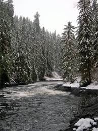 2. Naha Bay:, about 20 miles north of Ketchikan, in Behm Canal, just past Clover Passage. Naha is a magical place and is considered special by locals. It is next door to the tiny community of Loring, once the largest town in Southeast Alaska and the site of a large salmon cannery, where the remains of the cannery bunkhouses can still be found deep in the woods surrounding the turn-of-the century cannery location.
In its heyday, Loring was a port of call for large steamships bringing in goods, tourists and workers to the bustling town, but today Loring is simply a quiet home for about 30 families.
Naha Bay has a public dock and a trail that leads hikers to a series of upper lakes that are popular with local fishermen. The NahaRiver is a steelhead river, but be aware of the regulations and requirements if you decide to fish for that big one. NahaRiver empties into a lake which in turn runs into a salt chuck and a lagoon just inside the bay, providing spectacular scenic photo choices in all seasons.
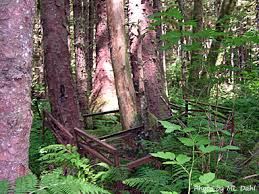 In winter this area usually gets significant snowfall and presents a winter wonderland for the hardy wintertime hiker and mariner. The area abounds with bear, wolf, fox, deer, mink, marten, harbor seals and eagles. In the old days, the salmon going upstream were prolific, but were fished out relentlessly and are only now returning in good quantities.
3. Traitors Cove: east Behm Canal, past Naha Bay on the same side of the canal. Traitor’s Cove has a dock, a buoy and a good anchorage, plus offers a handicap-accessible trail which leads to a bear-viewing station in the forest; visitors wishing to watch bears catch salmon should know that the bears only show up when the salmon are running in the streams but are around and should be avoided and kept at a safe distance at all times.
4. Port Stewart: a popular crabbing area across (on the mainland) from Naha Bay, which is a little tricky on entry but worth the effort. Watch your charts and avoid the shallow to the left of the entrance; it is well marked but deceptive visually. This protected bay is excellent anchorage, very good crabbing and has a remarkable feeling of remoteness rarely available in the lower 48. Be aware that the shore is brown bear territory, with numerous sitings of both male and female bears, often with cubs, so watch and keep a generous distance if you spot brownies at Port Stewart.
5. Helm Bay: just a stone’s throw farther up, on the same side as Port Stewart. Good anchorage, a small dock that gets shallow on the inland side at low tide and generally good crabbing. There is a US Forest Service cabin here, available for reservation. Brown bears are in the area; keep a keen eye out for any and stay your distance if you spot one.
6. Shrimp Bay & Klu Bay: crossing over to the island side (Revillagegido) are twin coves, first Shrimp Bay and behind it, Klu Bay. Very protected, excellent anchorages, with excellent crabbing and shrimping. Drop shrimp pots in 250+ feet and get the hot water ready ‘cause you are having spot prawns for dinner!
7. Neets Bay: further up on the island side of the canal is this anchorage. Fishing fleet boats come here to wait for openings, enroute to the fishing grounds. Good anchorage and sometimes you have neighbors for a night or two, so be prepared to visit. Neets Bay is the site of the Southern Southeast Alaska Regional Aquaculture hatchery, a salmon hatchery operation.
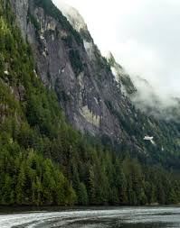 8. The abandoned Bell Hot Springs Resort: on the north end of Revillagigedo Island. From here, the trip around Revillagigedo turns south past Burroughs Bay, Walkers Cove, Manzanita Bay and the Punchbowl in the famed Misty Fjords National Monument, a must-see for visitors.
9. Misty Fjords National Monument: became a national treasure after local Ketchikan area conservationists and sportsmen and women petitioned the President and Congress to set this dazzling wilderness aside as a national Monument in the 1960s.
When the federal government agreed, Misty Fjords was born and today is accessible only by boat or floatplane. It is a wonderland of 3,000 foot high cliffs and narrow passages which are frequently shrouded in the mist from countless waterfalls and the ever-present rain of the rainforest that is the 17 million acres of the TongassNational Forest. A visitor can easily become so enchanted with his or her time in Misty Fjords that they will decide to stay put for several days and simply soak up the special feeling of this magical place.
10. Salmon Fishing:Visitors wishing to fish for salmon, halibut and rockfish while cruising will want to spend some time in the areas north of Ketchikan from Vallenar Rock to Clover Passage . The salmon enter the inside waters from the open ocean in great numbers in this area, so it is a popular and prolific fishing grounds.
South of town are good fishing grounds off of Mt. Point, which is the area where the island juts out and then turns inward towards GeorgeInlet and HerringBay. Good fishing is routine in GeorgeInlet and further south in Carroll Inlet.
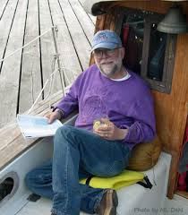 11. George Inlet and Carroll Inlet: offer excellent anchorage, buoy and some docking areas as well as great fishing grounds, with the added benefit of almost no traffic or other visitors. Often, a boat can sit quietly at anchor in either of these fjords and not see another boat for days. Favorite places include Ice House Cove, Gnat Cove, OstenIsland and Shelter Cove, used mostly by locals wanting a quiet place to explore, hike, hunt, fish and drop crab or shrimp pots.
12. Prince of Wales Island: about 20 miles west of Ketchikan, across Clalrence Strait, you come to the many coves, bays and villages on the east side of POW, which offers so many cruising opportunities that it would take most mariners years to see them all. Crossing Clarence Strait to arrive at any of the wonderful bays and coves on eastern POW requires respect for Mother Nature, however, as the open water can and does churn up big seas and very brisk winds sometimes, often without a lot of notice. Mariners are advised to listen to the weather report carefully before beginning the crossing, and waiting if it appears that conditions are not good, or deteriorating.
Whales are often reported on the eastern shoreline of Prince of Wales Island. Most are humpback whales and they tend to congregate in groups, putting on quite a show for mariners in the vicinity. There is a large colony of sea lions that most mariners observe as well, just off of Grindall Island on the Kasaan Peninsula of POW also, which are noticeable from a long distance away due to the roaring and the smell that is unique to a sea lion haul-out.
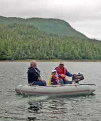 Once across Clarence Strait, the choices, of which there are too many, begin on the south of the island with the area surrounding Moira Sound. There are over 10 excellent places to anchor, visit, hike and fish in this area alone. Some include old, abandoned mine sites, old cabins long since left to rot and collapse in the forested nooks and crannies along the shoreline and the remains of logging camps shut down years ago during the decline of the timber industry in Southeast Alaska.
North of Moira Sound is Dolomi, the site of an old mine and long-ago small community near Port Johnson, Dora Bay in Chomly Sound and Kasaan Bay, which offers Skowl Arm, Mackenzie Inlet and Polk Inlet, all sites of old logging camps, canneries, mining sites and native villages. Today, a few groups of hardy Alaska families and individuals still live in scattered locations in KasaanBay and there are several fishing lodges located there during fishing season for the upscale fishing visitor as well. The fishing, as you would suspect, is legendary in these parts, bringing fisherpeople from all over the world to have a go at catching the big one.
Further up POW Island there are more great cruising destinations for the longer voyage, but our narrative will stop here. All of the destinations listed in this narrative allow the mariner visiting Ketchikan to cruise this area of Southeast Alaska for 2 or more days and return to Ketchikan within just hours for provisions, laundry facilities and refueling.
Welcome to the Ketchikan area cruising grounds of Southeast Alaska!
